Solution 01 · Fixed Camera
CCTV 固定摄像头定位
Fixed Camera Positioning
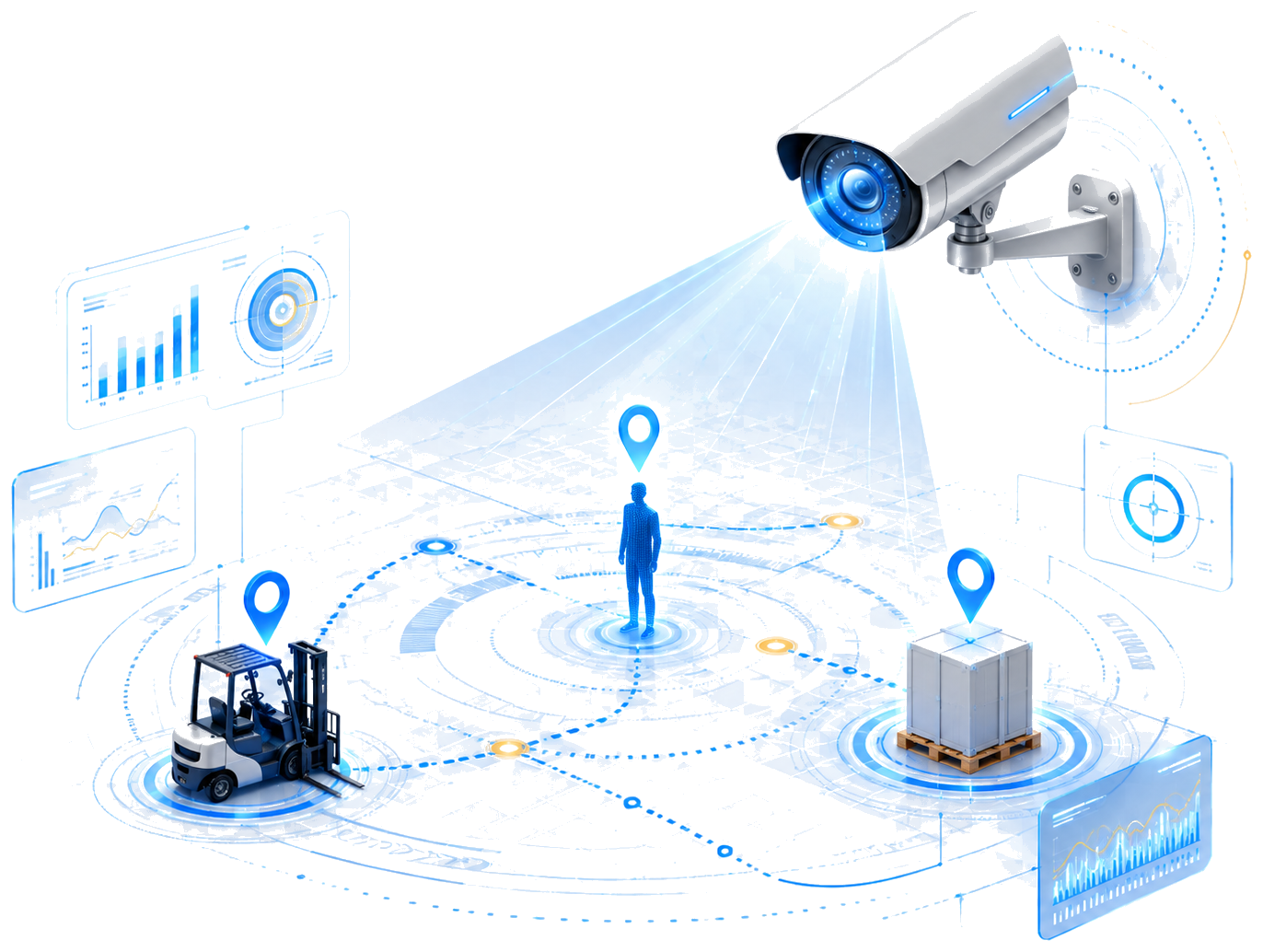
在环境中部署固定摄像头,AI 实时识别视野内移动的人员与车辆,输出空间坐标和轨迹,目标无需携带任何设备。
- 复用现有 CCTV,无需额外硬件采购
- 目标无需主动参与,被动识别追踪
- 多目标并发,支持 50+ 人同时追踪
- 区域告警 · 轨迹回放 · 热力分析

Visual Real-Time Location Platform
VisionRTLS 提供两种互补的视觉定位技术路径:CCTV 固定摄像头被动追踪人员与车辆;移动终端自定位供安卓设备或执法记录仪携带者获知自身精确坐标。
Two Solutions
Fixed Camera Positioning
在环境中部署固定摄像头,AI 实时识别视野内移动的人员与车辆,输出空间坐标和轨迹,目标无需携带任何设备。
Mobile Self-Positioning
人员携带安卓设备或执法记录仪,摄像头识别墙面打印的 SeekerLabel 标记,设备自主计算并上报当前位置坐标。
目标无需佩戴 BLE、UWB、RFID 等有源标签,摄像头直接识别人员或标签背心。
多摄像头协同计算,同时追踪 50+ 目标的实时位置与运动轨迹。
将视觉识别结果转换为 x / y / z 坐标与目标间距离数据。
热力图、停留分析、路径记录、效率统计与异常行为检测。
通过 API / TCP 对接大屏、告警系统、报表与业务平台。
Workflow
接入现场已部署摄像头,覆盖关键工作区域与出入口,复用现有 CCTV 基础设施。
识别穿标签背心的人员以及车辆、资产等目标对象,无需目标主动配合。
将视觉目标转换为空间坐标、距离信息与实时运动轨迹。
热力图、轨迹回放、工时统计、越界告警与异常分析。
对接大屏、WMS、MES、安防、应急指挥与管理平台。
Demo Video
Scenarios
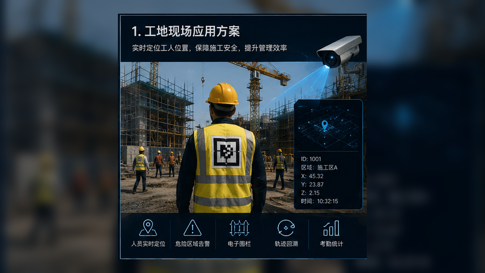
危险区域识别、人员定位追踪、工时统计与应急定位支持。
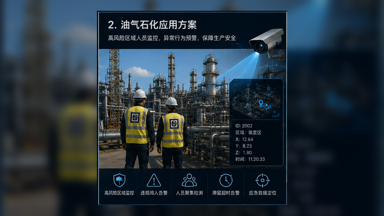
高风险区域管控、违章进入告警、长时间滞留超时预警。
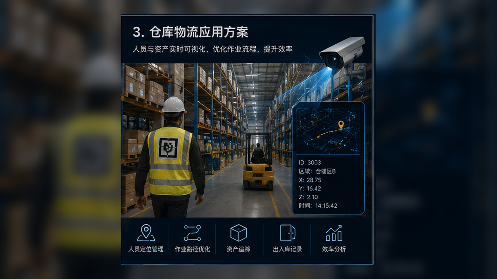
人员与叉车协同定位、作业路线优化、出入库流程追溯。
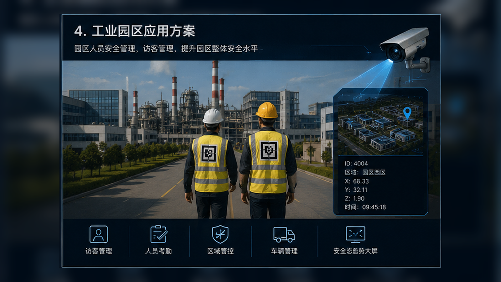
园区人员管理、访客与外包人员记录、车辆轨迹管理。
打印 SeekerLabel 二维码贴到墙面,无需布线、无需施工改造,数小时内完成部署。
OpenCV solvePnP 位姿解算,多标记加权融合,精度媲美 UWB,成本仅为十分之一。
支持普通安卓手机、PDA 手持终端与执法记录仪,无需专用定位硬件。
通过 WiFi / MQTT 将位置坐标实时推送至监控大屏,支持多人并发轨迹与预警。
移动时 5Hz 上报,静止时降至 1Hz,节省带宽与终端续航。
Workflow
打印 SeekerLabel 二维码,贴于走廊、产线、通道等关键位置,测量记录标记坐标。
人员携带安卓设备或执法记录仪,摄像头实时拍摄前方环境,检测视野内的 SeekerLabel 标记。
OpenCV solvePnP 计算相机与标记相对位姿,多标记融合输出精确 x / y / z 坐标。
坐标经 WiFi / MQTT 实时推送到监控大屏,支持多人并发轨迹显示与越界预警。
Demo
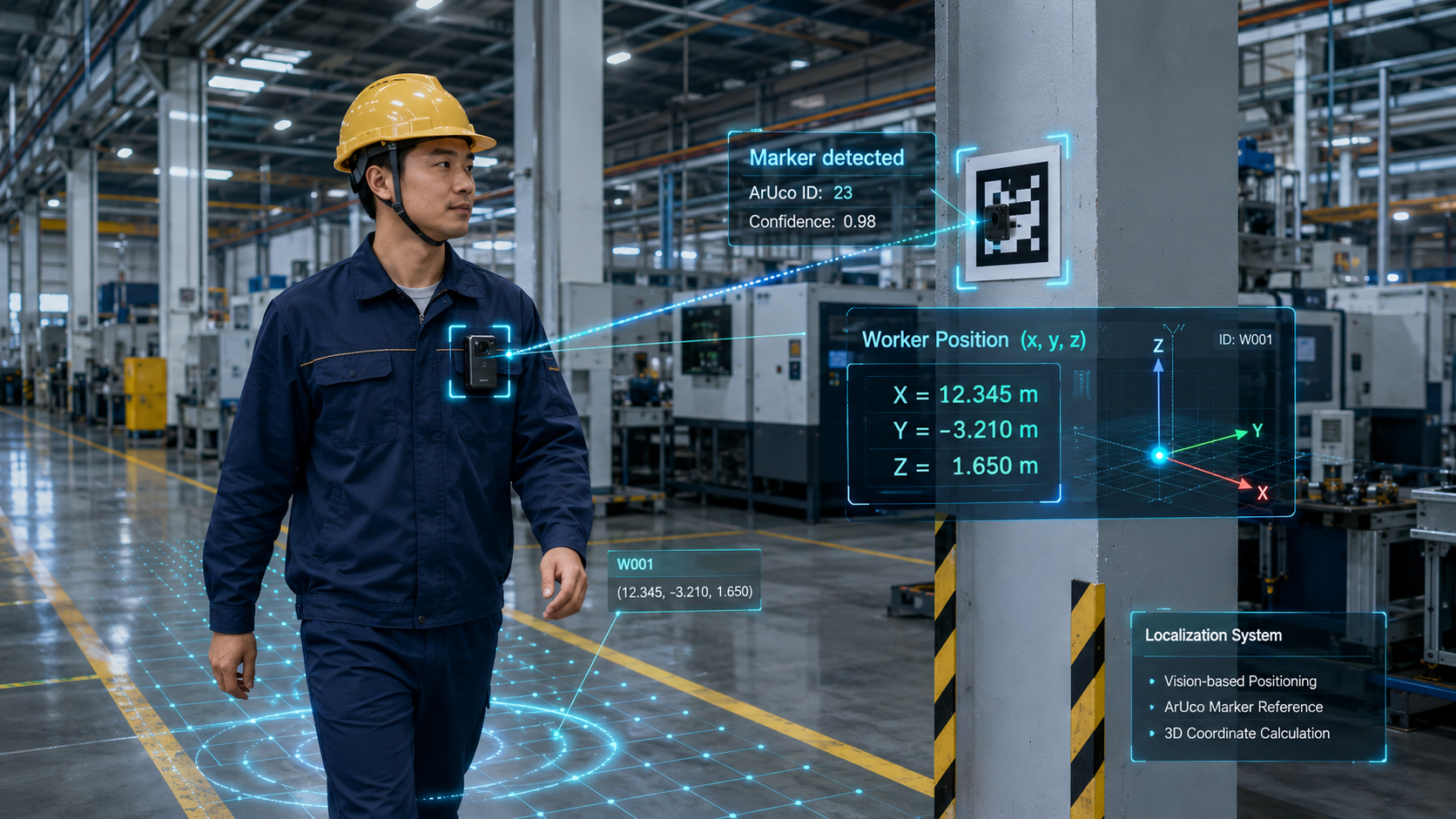
人员携带执法记录仪穿行于贴有 SeekerLabel 标记的环境,设备实时检测标记并解算出自身位置,坐标精度可达 ≤20cm,无需任何网络定位基础设施。
Scenarios
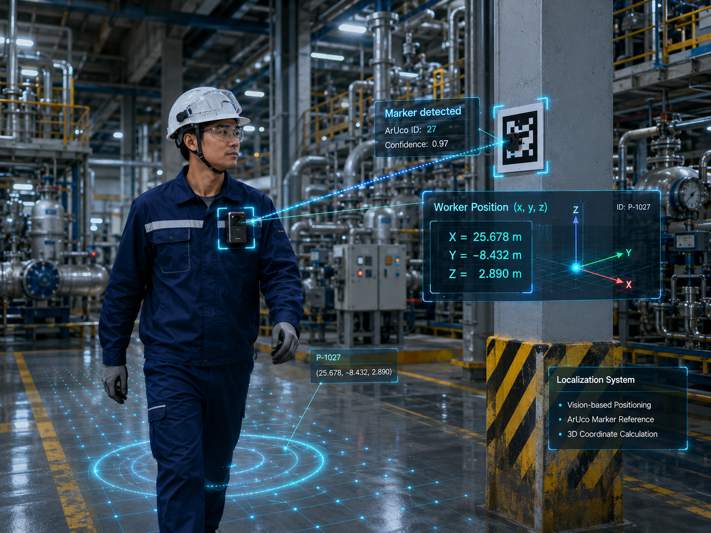
操作人员携带执法记录仪自主定位,实时掌握在装置区的精确位置,支持高温、高压等受限区域的安全巡检与应急响应。
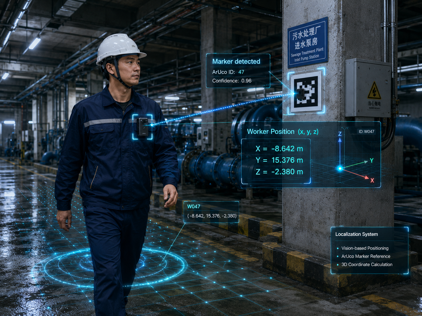
地下空间 GPS 全盲,执法记录仪结合SeekerLabel标签实现自主定位,巡检路线自动留存,异常区域精确记录,保障封闭空间作业安全。
Contact